Aerial photography is - as it sounds - the process of taking photographs from the air, but there is more to it than simply using a light aircraft or helicopter and flying up to take photographs. An aerial photograph, in broad terms, is any photograph taken from the air. Normally, aerial photography photos are taken vertically from an aircraft using a highly-accurate camera.
What is Aerial Photography?
The team at Sydney HeliTours are experts when it comes to aerial photography. Quite often photographers require an aerial perspective of locations. Aerial photographs have an advantage over ground level photographs. An aerial view enables the whole of an area to be observed, rather than just a portion of it.
Let’s use a construction site as our first example. There are quite often times where a construction company will want aerial progress photography to show the continuing development of a particular location. The construction company may want to have aerial photography taken of the site every 2 to 4 weeks over the whole period of the development and construction of the site. This gives the property developers a very useful tool showing progress of the development site.
 Aerial photography is an amazing tool for real estate agents, quite often a real estate agent will want aerial photography of the site that is up for sale to show the size of the property and its relative location to the surrounding area or its relative location to places like school’s train stations hospitals or shopping precincts. The advantage of the use of aerial photography is it gives the photographer the opportunity to have things like the city sky line incorporated into the shot showing relative location to the CBD. Taking a photograph straight down over a landscape is the more familiar form of aerial photography. It is a plan view so there is no perspective to distort the image.
No doubt you have seen a photo or a drawing showing the finished product of a future shopping centre or school or housing development, quite often these artists impressions are based on aerial photos that have then had the completed development incorporated into the artist’s finished impression.
Aerial photography is not just limited to construction companies and real estate agents.
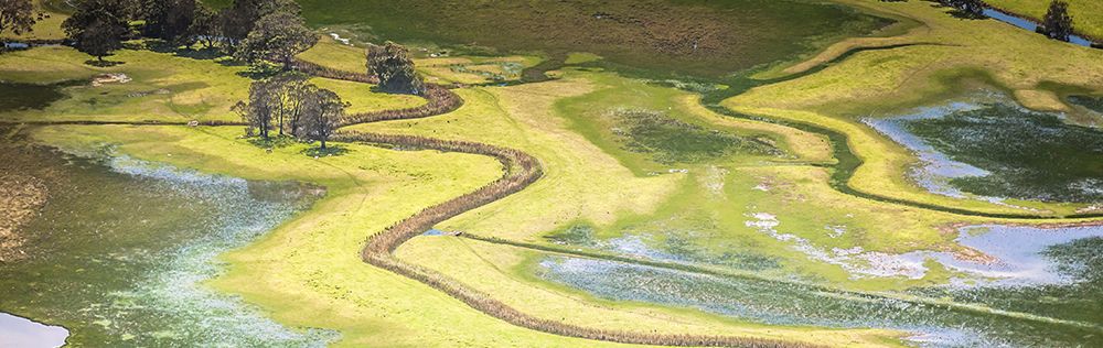
Let’s use climate change as an example, we all know about the effects of climate change on global temperatures. These global changes are reflected everywhere, and societies and communities are seeing changes to their local environment. Researchers use aerial photographs to keep vital records in changes over seasons and years to track local effects of climate change and risks to local ecosystems. The photos take from the air can show in great detail the changes taking place.
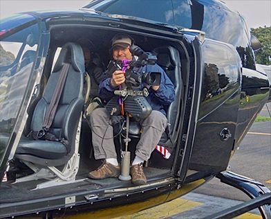
One of our shots taken from the airv
You are probably using aerial photography and don’t even realise it. The world’s most famous aerial photography application is Google Earth! Google Earth is the ultimate in aerial photography, Google earth is basically millions of photos taken from satellites and then stitched together.
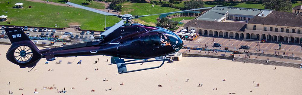
How is all this aerial photography actually done? Well there are numerous ways of actually capturing aerial photography and out of a helicopter is by far the most commonly used way of capturing aerial photography. Helicopters have the ability to get the photographer directly over the top of or beside the intended item or location being photographed. With the ability for the helicopter to hover this gives the photographer the perfect platform to take the aerial photographs from.
The Team at Sydney HeliTours specialise in aerial photography so contact us today and let us discuss with you your aerial photography requests or requirements.